Reading Time: 5 Minutes 41 Seconds
Intro
This is one of my favourite autumn bike rides, which I keep doing every year – and sometimes multiple times a year.
It is very interesting to see how the landscape changes.
The route goes from Kadaň to Teplice (completely flat) or further to Ústí nad Labem (with few hilly sections), and it follows most of the trail 66 – Pánevní, with a main diversion.
On this trail you ride at the foot of the Ore Mountains (Krušné hory) and explore one of the mining regions of the Czech Republic.
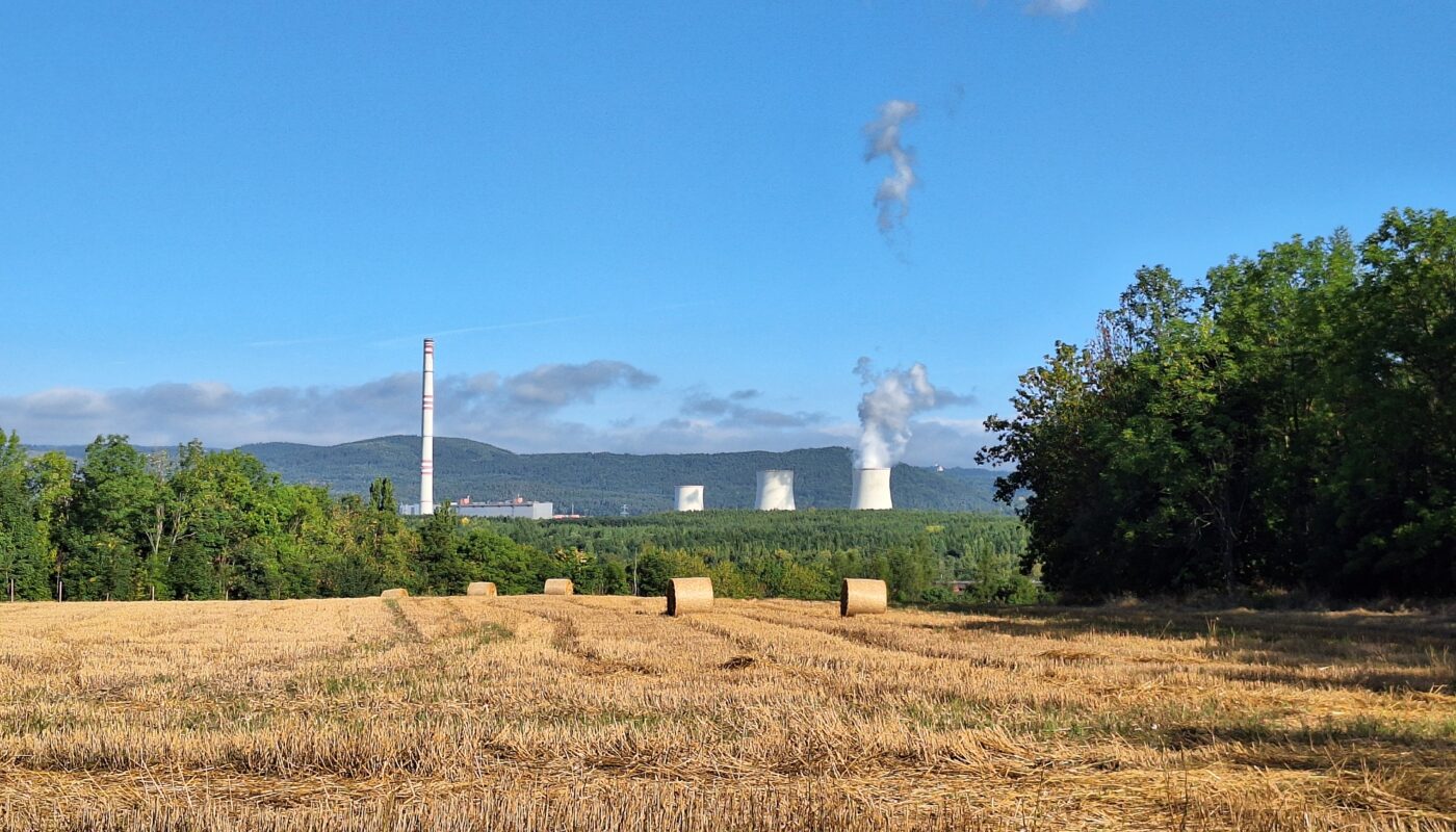
In fact, the first section runs along the border of the vast brown coal open-pit mine Nástup – Tušimice.
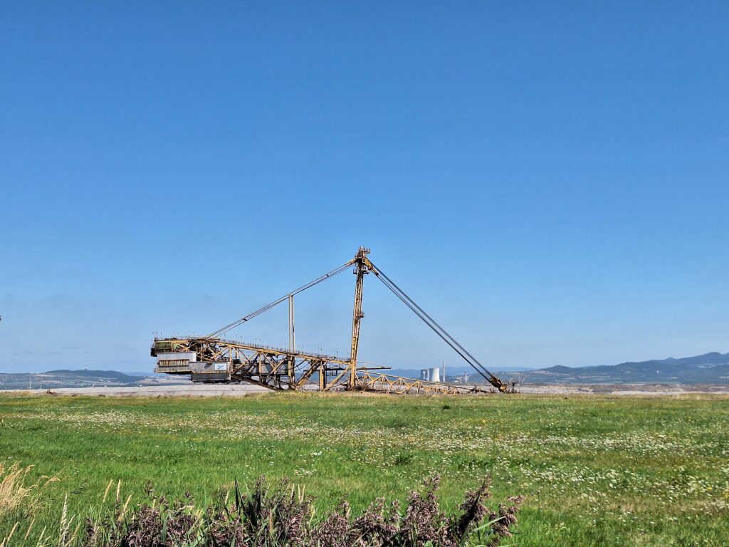
The coal extraction activity is still going on, and you will see the huge brown hole and bucket-wheel excavators far away.
For few years, it was possible to participate to the so-called “Coal Safari”, which toured a couple of coal pits in the area, bringing people down to see those huge dinosaurs scrape the coal.
How to reach to the starting point of the ride
The train journey from Prague to Kadaň is quite long, but the train seats are comfy and you can sleep or watch a movie on your phone – there are electric plugs under each seat. In addition, early morning trains are not very crowded.
You can also get to Kadaň by car and take a train back at the end of the ride, as both Teplice and Ústí are on the same line.
To start the ride, you get off in Kadaň-Prunéřov, which is in the middle of nowhere, but it is the only useful stop on the main railway line.
I usually cycle from the train station into town for a second breakfast and then return.
You can do the same or you can switch to the local train (which is probably already on the other track waiting for you) to reach Kadaň main station.
Alternatively, you can start the ride directly from Kadaň-Prunéřov train station, without passing through town.
I typically stop either at Es Café in the main square (point 5) or at Kavárna U Krištofa (point 4 – the entrance is from Komenského street).
The ride and the coal pits
Kadaň => Chomutov
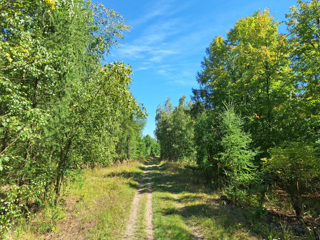
You leave Kadaň by riding through the city park and passing under a railway bridge via an almost hidden passage adjacent the Kadaňský stream.
Then, you immediately crisscross a forest in a recultivated area of the mine, and you should be careful of the road signs regarding where it is allowed and not allowed to pass. Anyway, the cycling path is always marked with the usual yellow signposts.
It is time for a short uphill climb over an orange and blue bridge that crosses a belt conveyor used to transport coal from the mine to Kadaň-Prunéřov power station.
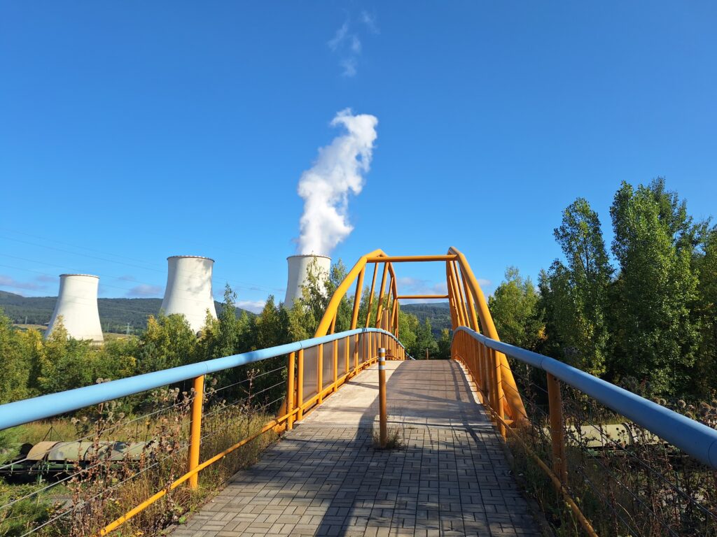
At the crossroad at bottom of the bridge starts the trail that parallels the Nástup – Tušimice coal pit.
You are allowed to ride (or walk) only on the cycling path, as the road and rest of the area belong to the mining company.
The path is paved, long and straight until Černovice village, where it switches to a short unpaved stretch and then again to asphalt.
If you are lucky, the wind will blow from behind and you will see cows in the fields.
In Spořice you are back to civilization and basically at Chomutov’s door.
If you haven’t stopped for a snack in Kadaň, then this is the time to do so, before entering another section of no man’s land.
Then, you cross the town to get back on the cycling path between the zoo and Kamencové lake, along the Otvice pond and further.
Chomutov => Most
At the end of the cycling lane, you leave the Pánevní trail and turn left to join the main road that borders the Újezd reservoir. Cars tend to run here, so be careful.
Immediately after the railway bridge, you turn right to a sort of abandoned lane to follow the 3107 path.
The metal bar at the entrance of the roas is sometimes closed, but you can still go in.
A bit uphill you reach the ex-train station of Kyjice, which served the village of the same name, demolished to make way to the actual reservoir.
The station does not work for passengers and the trains just pass by, but the area is not completely closed and there is always someone in the office building.
Continue on the path along the rail line, that runs between two other coal mines: the Vršany pit and the huge ČSA pit (Československé armády/Czechoslovak Army).
Unfortunately, you won’t see any digging activity, as the quarries are not visible from there and the vegetation covers the view. But if you are lucky, you will meet a heard of mouflons!
Follow the indications to leave the asphalt and enter the forest down to your left.
You come out to join a proper asphalt road that will bring you to the renown food stall “U Maďara” at point 7.
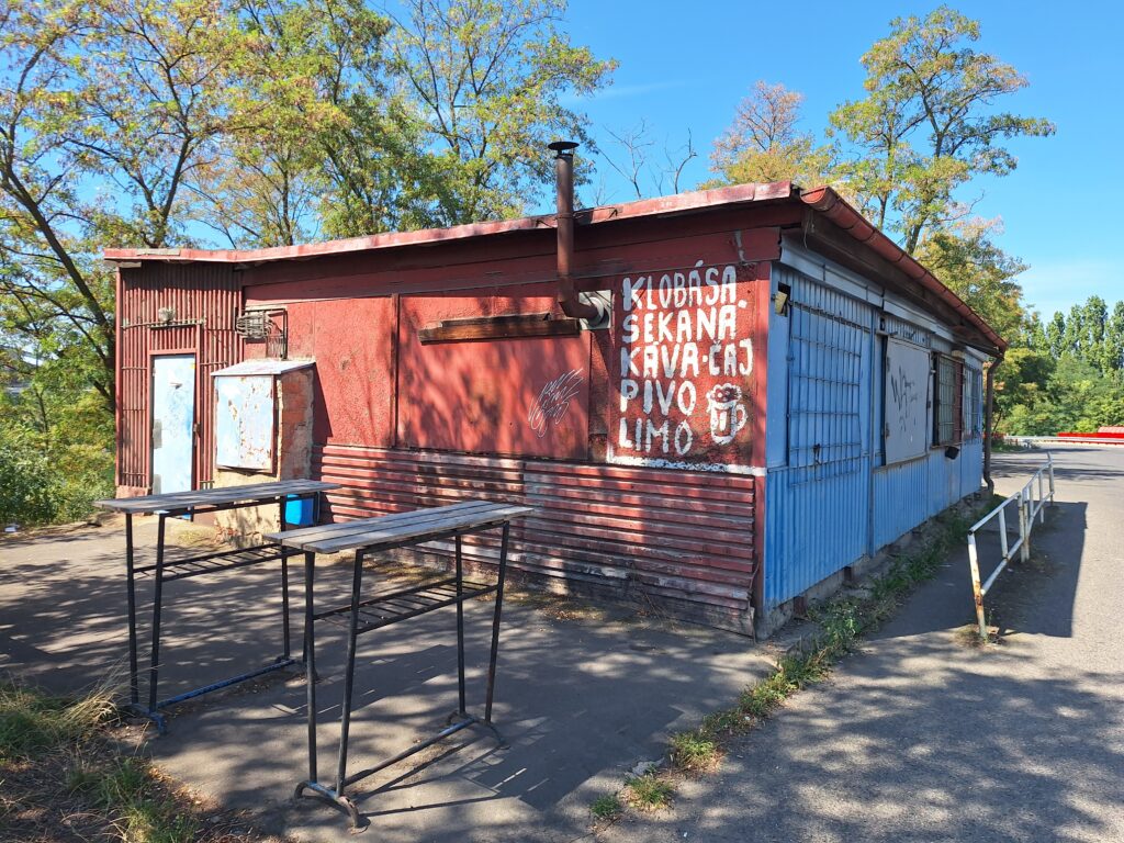
It serves typical cheap Czech food, even though its name literally means “At the Hungarian”.
You will probably find it closed, thinking that it is abandoned, but it only operates on work days from 6 in the morning until 13.
You are a bit over the half of the ride and continue to pedal in another desolated area, which underwent recultivation after mining activities.
Most => Teplice
Before entering Most, divert to the “25 – Jezerní” trail that goes around the western and northern sides of the Most lake, created from a previous mine.
There are several points where you can stop for a pause or to enjoy the view and the breeze.
On clear days you can see the southern side of the lake, which has a pebble beach with umbrellas, bars and other attractions. And of course, Hněvín castle too.
Leave the lake at your back and continue on the same trail to reach the main road that brings you to Lom.
On the way, you can peak at another huge brown coal pit, the Bílina quarry.
In Lom you go a bit off-road to a nice section that follows the Loučenský stream until Duchcov, and from there you finally reach Teplice via the 3083.
If Teplice is your last stop before jumping on a train, or if is just a riding pause, I recommend you to drop by the Monopol brewery and restaurant for a tasty meal (and beer too, if you wish). It is marked at point 10.
I hope you enjoyed this unusual ride and see you next time!